10,726 people live in Sonoma, where the median age is 54.4 and the average individual income is $72,127. Data provided by the U.S. Census Bureau.
Total Population
Median Age
Population Density Population Density This is the number of people per square mile in a neighborhood.
Average individual Income
Sonoma's center is still built around the plan General Vallejo laid out in 1835: an eight-acre Plaza at the center, with a street grid around it.
What keeps that shape intact today is a voter-approved urban growth boundary, renewed in 2020 and set through the end of 2040. For buyers, it means where a property sits relative to that line matters. For the story behind the Plaza, read the history of Sonoma.
The eight-acre Plaza was dedicated a National Historic Landmark in 1961. Mission San Francisco Solano (founded 1823), the Sonoma Barracks, and the Bear Flag Monument are on or next to it. More landmarks are covered in architectural landmarks in Sonoma, CA.
The urban growth boundary, first approved in 2000 and renewed in 2020, bars urban development outside the line, with exceptions such as schools and parks.
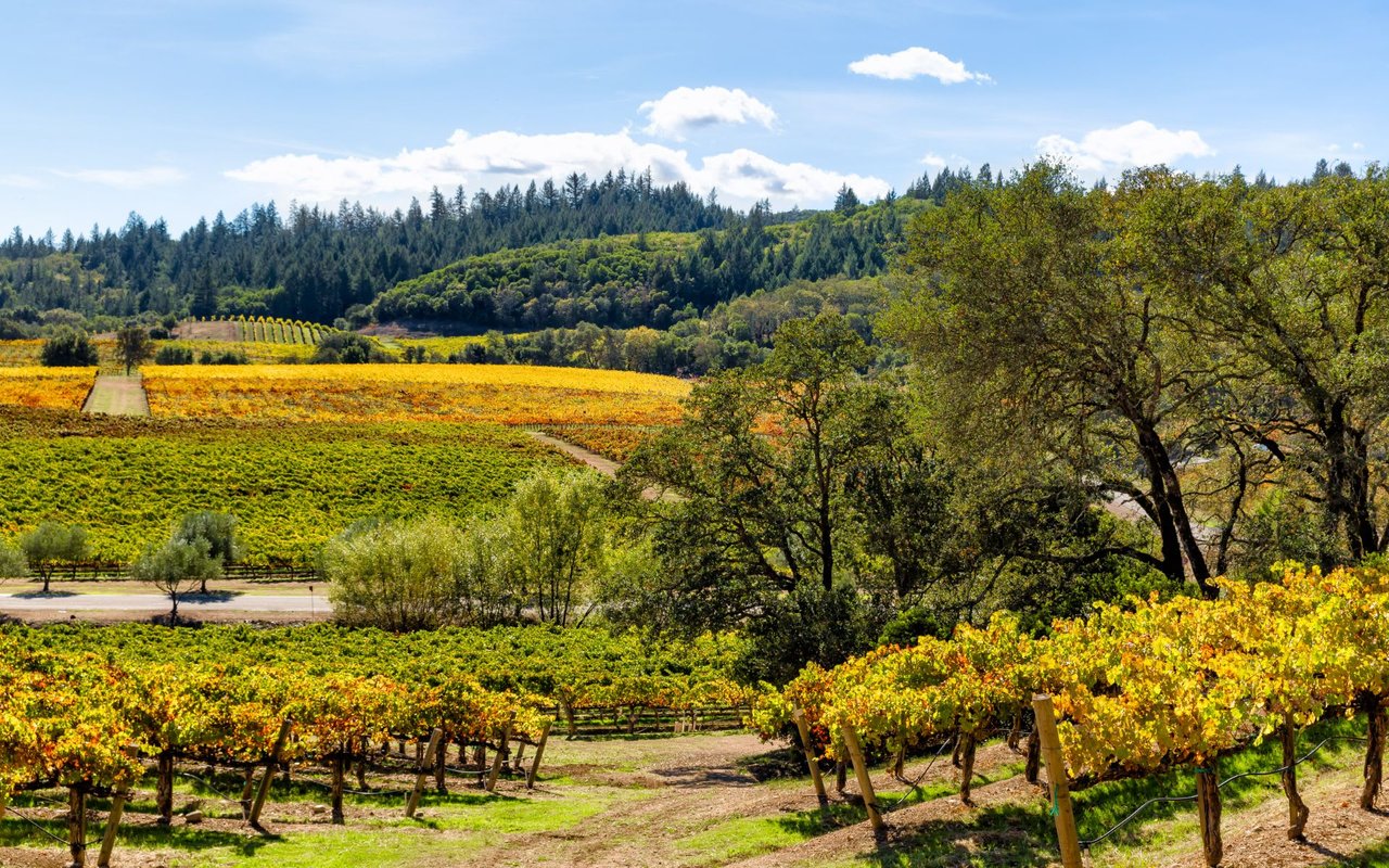
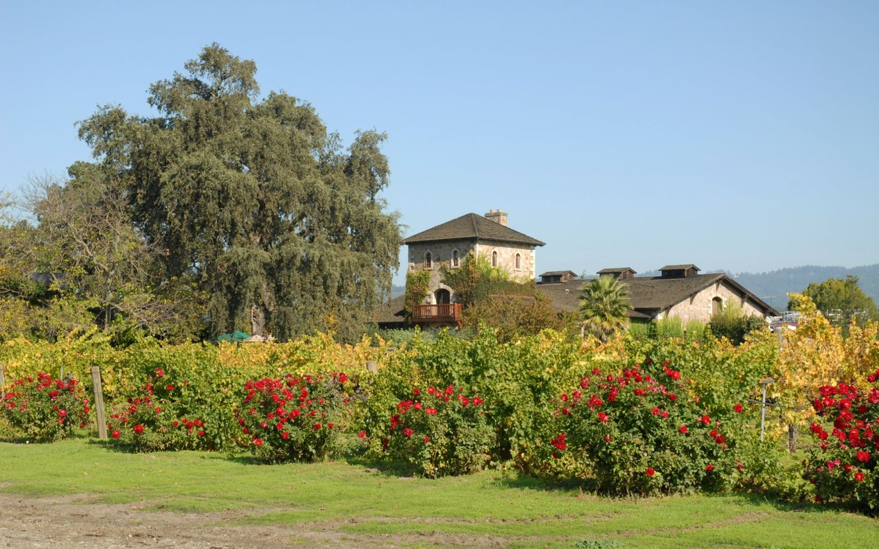
Buena Vista Winery, founded in 1857 and designated California Historical Landmark #392, is at 18000 Old Winery Road. The Sonoma Valley appellation was established by the federal government in 1981. For tasting rooms, see luxury winery experiences in Sonoma.
The Sonoma Overlook Trail runs nearly 3 miles above the city, and Sonoma Valley Regional Park has a paved trail of about 1.2 miles one way. Sonoma outdoor activities lists more.
Jack London State Historic Park covers about 1,400 acres, and Sugarloaf Ridge State Park has a summit at 2,729 feet. Plan a full day with how to spend a day outdoors in Sonoma.
The Sonoma Valley Museum of Art is at 551 Broadway, one-half block up from the Plaza, according to the City of Sonoma.
Vella Cheese Company, founded in 1931, still makes its cheese in its stone building on Second Street East, which the company calls its founding building.
The Plaza is the center of the town plan. City Hall, completed in 1908 in the Mission Revival style, stands on it. The Bear Flag was raised here on June 14, 1846, and the Bear Flag Monument stands at the northeast corner. For what has changed on the square lately, read The Plaza's Two New Corners.
01
Sonoma State Historic Park includes the Mission (114 E. Spain Street), the Sonoma Barracks (36 E. Spain Street), and General Vallejo's home, Lachryma Montis (363 Third Street West). The State also acquired the Toscano Hotel (1957) and the Blue Wing Inn (1968).
02
Beyond Buena Vista, Cornerstone Sonoma (23570 Arnold Drive) and Cline Family Cellars (24737 Arnold Drive) are both on Arnold Drive. Bartholomew Estate (1000 Vineyard Lane) sits within what the estate describes as a 375-acre private, non-profit park.
03
There is a seasonal Tuesday evening farmers market on the Plaza, typically May through early September. Annual events on the Plaza include the Bear Flag Celebration in June, Oktoberfest in October, and the Holiday Lighting and Lighted Tractor Parade in November. The Valley of the Moon Vintage Festival traces its history to 1897. Check current dates before you go, and see summer concerts and outdoor events.
04
The Sonoma Overlook Trail sits on the hillside above the city. Montini Open Space Preserve, managed by Sonoma Ecology Center in partnership with the City of Sonoma, has trail access at 4th Street West and Haraszthy Drive. Sonoma Valley Regional Park (202 acres, 13630 Highway 12) has a dog park, and Maxwell Farms Regional Park (82 acres, 100 Verano Avenue) has sports fields, a playground, and a skate park. Dog owners can also browse best places for fun with your pets in Sonoma.
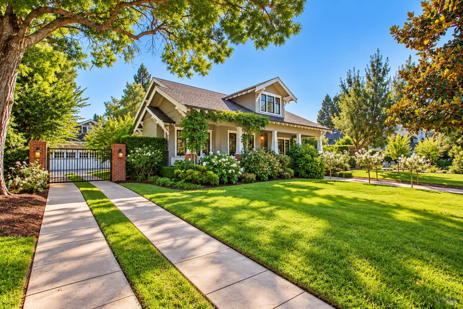
Older buildings surround the Plaza. Preserve Sonoma's Plaza guide lists adobes from about 1835 to 1846, Italianate buildings from the 1880s and around 1890, and Mission Revival and Spanish Revival buildings from the early 1900s through the late 1930s. Where you buy shapes how you live, and the settings break down like this:
The Plaza and the streets around it fall under City of Sonoma planning and utilities.
Boyes Hot Springs, El Verano, and Fetters Hot Springs-Agua Caliente are unincorporated census-designated places in Sonoma County, outside the City of Sonoma.
Glen Ellen and Kenwood each have their own guide on this site, linked below.
Larger estate and vineyard properties are covered in our posts on selling a Williamson Act vineyard estate, vineyards to villas, and choosing between Napa and Sonoma Valley. For neighborhood-level detail, see Sonoma's most exclusive luxury neighborhoods, what walkability costs in Sonoma real estate, and how the cost of living compares with nearby cities.
A property that looks right in the photos can behave very differently once you check these four things.
Measure W keeps the growth boundary in place through December 31, 2040. Only voters can change it, with limited exceptions the City Council can approve by a four-fifths vote. If a property sits outside the city, confirm directly which jurisdiction and which utilities apply.
The City's primary water source is the Russian River, delivered through Sonoma Water, with deep wells that supplement the purchased supply. Wastewater in Sonoma is handled by the Sonoma Valley County Sanitation District. The City's water division also serves an area outside the city limits, so confirm the provider for any specific address.
The State Fire Marshal's Fire Hazard Severity Zones classify State Responsibility Area land as Moderate, High, or Very High, and they measure hazard rather than risk. Look up the specific parcel, and ask about defensible space. California's law calls for 100 feet of defensible space around a structure, and CAL FIRE calls the first five feet from the home the most important. The 2017 Nuns Fire, part of the Central LNU Complex, burned in Napa and Sonoma counties, according to CAL FIRE.
The City Council adopted regulations prohibiting new vacation rentals on December 4, 2017, and unincorporated Sonoma County has its own rules. The City's vacation rental page does not address whether a license transfers on a sale, so confirm with the City before you count on rental income. Sonoma's municipal code also has a chapter on historic preservation and infill (19.42), and the City has a Historic Preservation Commission, so check with the City before you plan exterior changes.
Start with the right questions to ask before buying a home in Sonoma and what you need to know about buying. If you are weighing a build, see building a house in California. For contracts, understanding real estate contingencies explains how they work, and decoding the relationship between home age and market value in Sonoma looks at that question.
SMART rail does not reach Sonoma. Sonoma County Transit runs Route 32 (the Sonoma Shuttle, which serves the Plaza), Route 30 between Sonoma Valley and Santa Rosa, and Route 34 on weekday commute-period trips between downtown Santa Rosa and the Plaza. It also runs weekday commuter service between the Plaza and Petaluma, so check sctransit.com for the current route. The Charles M. Schulz Sonoma County Airport is at 2200 Airport Boulevard in Santa Rosa. SMART's Sonoma County Airport station is about a mile away and is linked by the SMART Connect shuttle.
Sonoma Valley Unified School District serves the area. Confirm which school serves a specific address with the district.
Home to Jack London State Historic Park, about 1,400 acres with the Wolf House ruins and more than 26 miles of trails.
Sugarloaf Ridge State Park, at a Kenwood address, has a 2,729-foot summit, about 25 miles of trails, and an observatory.
Home to the Oxbow Public Market on First Street, a 40,000-square-foot marketplace with an outdoor deck.
The Plaza is an eight-acre public square at the center of Sonoma, laid out by General Vallejo in 1835. City Hall stands on it, and the Mission, the Barracks, and the Bear Flag Monument are on or next to it. It was dedicated a National Historic Landmark in 1961.
No. SMART rail runs from Windsor to Larkspur and does not reach Sonoma. Sonoma County Transit serves the Plaza with Route 32 (Sonoma Shuttle), Route 30 connects Sonoma Valley with Santa Rosa, and weekday commuter service links the Plaza with Santa Rosa and Petaluma. SMART's Sonoma County Airport station in Santa Rosa is about a mile from the airport.
It is a voter-approved line around the city, first approved by voters in 2000 and renewed in November 2020 as Measure W through December 31, 2040. Urban development is barred outside it, with exceptions such as schools and parks. Only voters can change it, apart from limited exceptions the City Council can make by a four-fifths vote.
Inside the City of Sonoma, the City Council adopted regulations prohibiting new vacation rentals on December 4, 2017. Existing licensed rentals may continue if they meet the operating standards, and there is an exception for adaptive re-use of a historic structure. Unincorporated Sonoma County has its own rules, so confirm the rules for any specific address with the City or Permit Sonoma.
The State Fire Marshal's Fire Hazard Severity Zone maps classify State Responsibility Area land as Moderate, High, or Very High hazard. They measure hazard, not risk. For State Responsibility Area parcels you use the state viewer, and for Local Responsibility Area parcels you contact the local jurisdiction. California's defensible space law calls for 100 feet around a structure.
You can walk the Sonoma Overlook Trail above town, tour the Mission and Barracks, visit the Sonoma Valley Museum of Art, or drive up the Valley to Jack London State Historic Park and Sugarloaf Ridge State Park. The Plaza also hosts a seasonal Tuesday evening market and several annual events.
Sonoma Valley Unified School District lists Sonoma Valley High School, Creekside High School, Sonoma Valley Middle School, and El Verano, Flowery, and Sassarini elementary schools. Confirm which school serves a specific address with the district.
Whether you are looking near the Plaza or at land outside the boundary, we can tell you what the address means in practice.
Call 415.290.3123
There's plenty to do around Sonoma, including shopping, dining, nightlife, parks, and more. Data provided by Walk Score and Yelp.
Explore popular things to do in the area, including Peet's Coffee, Coffee & Coco, and Krave Jerky.
| Name | Category | Distance | Reviews |
Ratings by
Yelp
|
|---|---|---|---|---|
| Dining · $$ | 0.08 miles | 79 reviews | 4.2/5 stars | |
| Dining | 0.1 miles | 1 review | 5/5 stars | |
| Dining · $$$$ | 0.11 miles | 20 reviews | 3/5 stars | |
| Dining | 0.11 miles | 1 review | 5/5 stars | |
| Dining | 0.12 miles | 0 reviews | 0/5 stars | |
| Dining · $$ | 0.12 miles | 162 reviews | 4.8/5 stars | |
| Dining · $$$ | 0.12 miles | 513 reviews | 3.9/5 stars | |
| Dining | 0.12 miles | 0 reviews | 0/5 stars | |
| Dining | 0.13 miles | 1 review | 5/5 stars | |
| Shopping | 0.12 miles | 46 reviews | 3.7/5 stars | |
| Active | 0.08 miles | 5 reviews | 5/5 stars | |
| Active | 0.1 miles | 1 review | 5/5 stars | |
| Active | 0.12 miles | 0 reviews | 0/5 stars | |
| Beauty | 0 miles | 0 reviews | 0/5 stars | |
| Beauty | 0.04 miles | 1 review | 5/5 stars | |
| Beauty | 0.04 miles | 1 review | 5/5 stars | |
| Beauty | 0.06 miles | 3 reviews | 5/5 stars | |
| Beauty | 0.07 miles | 31 reviews | 3.9/5 stars | |
| Beauty | 0.08 miles | 6 reviews | 5/5 stars | |
| Beauty | 0.09 miles | 19 reviews | 4.9/5 stars | |
| Beauty | 0.09 miles | 0 reviews | 0/5 stars | |
| Beauty | 0.11 miles | 0 reviews | 0/5 stars | |
| Beauty | 0.12 miles | 0 reviews | 0/5 stars | |
| Beauty | 0.12 miles | 3 reviews | 5/5 stars | |
|
|
||||
|
|
||||
|
|
||||
|
|
||||
|
|
||||
|
|
Sonoma has 5,258 households, with an average household size of 1.98. Data provided by the U.S. Census Bureau. Here’s what the people living in Sonoma do for work — and how long it takes them to get there. Data provided by the U.S. Census Bureau. 10,726 people call Sonoma home. The population density is 3,909 and the largest age group is Data provided by the U.S. Census Bureau.
Total Population
Population Density Population Density This is the number of people per square mile in a neighborhood.
Median Age
Men vs Women
Population by Age Group
0-9 Years
10-17 Years
18-24 Years
25-64 Years
65-74 Years
75+ Years
Education Level
Total Households
Average Household Size
Average individual Income
Households with Children
With Children:
Without Children:
Marital Status
Blue vs White Collar Workers
Blue Collar:
White Collar: